About Us
The Shire of Wongan-Ballidu
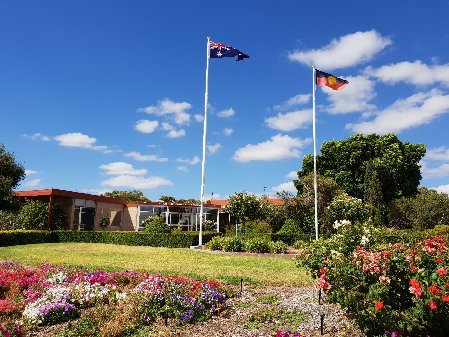
Shire of Wongan-Ballidu Administration Office
The Shire is located in the Wheatbelt region of Western Australia and covers an area of 3,368 square kilometres. The localities within the Shire are Ballidu, East Ballidu, West Ballidu, Burakin, Cadoux, Kondut, Lake Hinds, Lake Ninan, Mocardy and Wongan Hills. The Shire consists of undulating land with various soil types and granite outcrops.
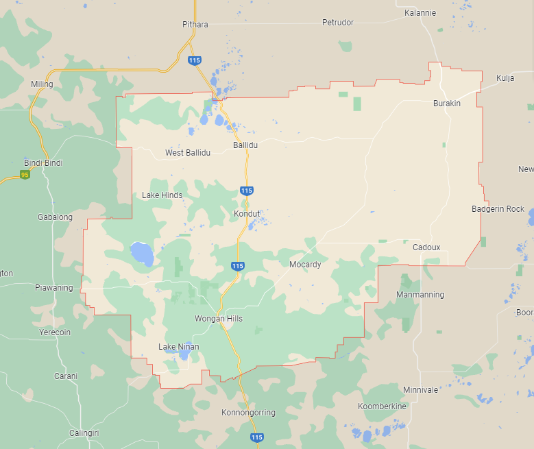
Shire of Wongan-Ballidu covers an area of 3,368sq/km
Acknowledgement of Country
The Shire of Wongan–Ballidu acknowledges the Ballardong and Yued Noongar people as the Traditional Custodians of the land on which we live, work, and gather. We recognise their deep and ongoing connection to Country, and we pay our respects to Elders past and present. We extend this respect to all First Nations peoples in our community.
Ballardong and Yued Noongar History
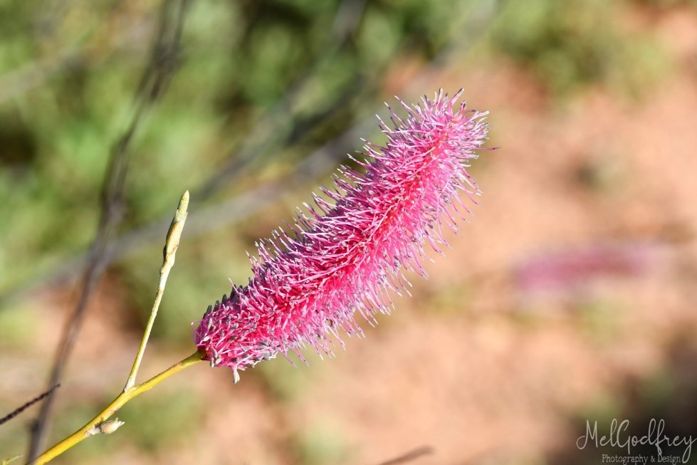
Pink Poker (Grevillea petrophiloides) – Shire of Wongan-Ballidu emblem
Ballidu, directly North of Wongan Hills and 219km north east of Perth is the second largest town within the Shire. Ballidu’s name is derived from the Indigenous name given to a nearby spring. Local residents preferred the Indigenous name “Balli” however the Lands Department wanted to call the town “Duli”. A compromise was reached and Ballidu was named in 1914. The third town site of Cadoux is located 200km north east of Perth (via Dowerin). It was suggested by the local Road Board Secretary to name the locale “Cado” after a local farmer. The correct spelling of “Cadoux” was later confirmed and honours Donald Cadoux, a French-Canadian settler who arrived in WA in 1909 and later died in Gallipoli during WW1. Cadoux was founded in 1929 and is the site of the second most damaging earthquake in the history of Western Australia. The damage was estimated at $3.8 million at the time of the 1979 disaster.
Our region is most well-known for its beautiful wildflowers which bloom between October and December each year. The area is extremely diverse with more than 1400 species of flowering plants, 24 species are unique to Wongan Hills. Reynoldson’s Flora Reserve displays a stunning array of colour attracting tourists from all over Australia.
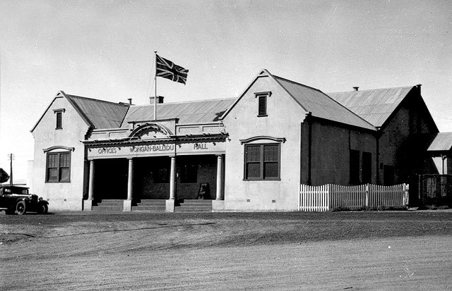
Shire of Wongan-Ballidu Offices and Town Hall
The Shire of Wongan-Ballidu is a well serviced area comprised of a primary school, district high school, hospital, medical centre, childcare centre, dentist, as well as a newly developed sporting complex within the townsite of Wongan hills boasting a gymnasium, excellent sporting facilities for our many proactive sporting clubs and a swimming pool. The area has lots to offer, many tracks and trails to walk, a welcoming community and incredible facilities throughout. Being only a short distance from Perth but has all the advantages country living can offer, the Shire of Wongan-Ballidu is the lifestyle to love.